Browse

···
Log in / Register


 6
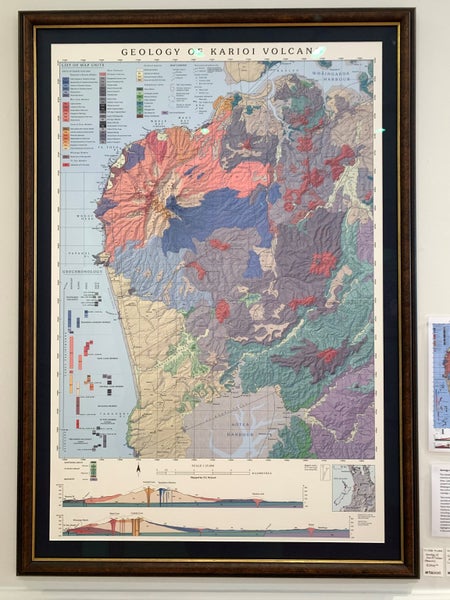
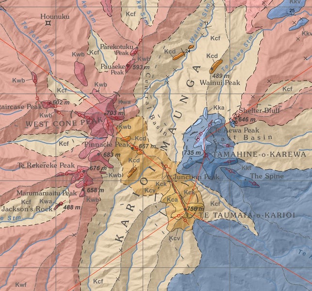
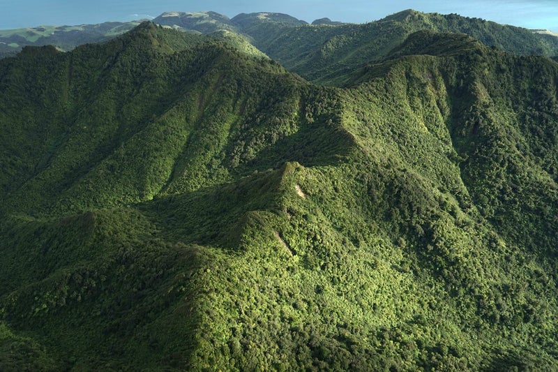
6This is your chance to own a unique geological map offered directly from the author's personal collection. Towering above the famous surf breaks of Raglan, Karioi is a 2.6 million-year-old stratovolcano with an explosive and mysterious past. Its coastal lavas sparkle with black crystals reminiscent of the ocean islands of Tahiti and Rarotonga, while the upper slopes echo the andesitic structures of Taranaki. Karioi is a geological anomaly, formed by the eruption of two distinct magmas that collided at the edge of the Pacific subduction zone around 3 million years ago. How, and why, this happened has remained an enduring mystery for the international geoscience community, largely due to the absence of a proper geological map. ‘Geology Karioi Volcano’ is the first detailed depiction of Karioi's stratigraphy. It is the product of several thousand hours of field research and cartography. Samples were painstakingly collected throughout the mountainous bush, sheer cliffs, and boulder beaches to piece together the volcano’s hidden past. The map's design pays homage to the pre-eminent work of Hochstetter (e.g. the 1859 Auckland Volcanic Field map) and more contemporary map stylings from the ‘golden age’ of the United States Geological Survey (1960s-80s). The map’s creation inspired the forthcoming full-length documentary 'Tirohia Karioi', set for release on 6 September 2025. Discoveries revealed through the mapping process are the subject of three major exhibitions in the Waikato region (beginning 2026). ‘Karioi’ was designed and offset printed in New Zealand on 95 gsm Ragmap cartographic paper. Dimensions 720x1080mm. Total print run: 500 sheets (of which 100 are flat maps). The map has been displayed in numerous exhibitions, galleries, conferences and private homes since release in September 2024. The map comes rolled in a cardboard tube (not framed) and is signed by the author O.E. McLeod. It is accompanied by a signed certificate of provenance which describes the map and production details.